Your say / Brislington Meadows
‘Too steep to be fair – the Brislington Meadows plans still won’t work’
Keepmoat Homes and Homes England want to build up to 260 homes at Brislington Meadows in south Bristol.
Their previous plans were refused by the council’s planning committee in May 2026 because the estate’s roads would be too steep for many people to use.
While it’s possible that they may appeal the refusal, they have also resubmitted their application as a fallback. The engineering drawings they rely on show the roads haven’t changed though.
is needed now More than ever
The problem is the hill
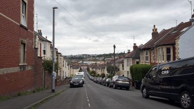
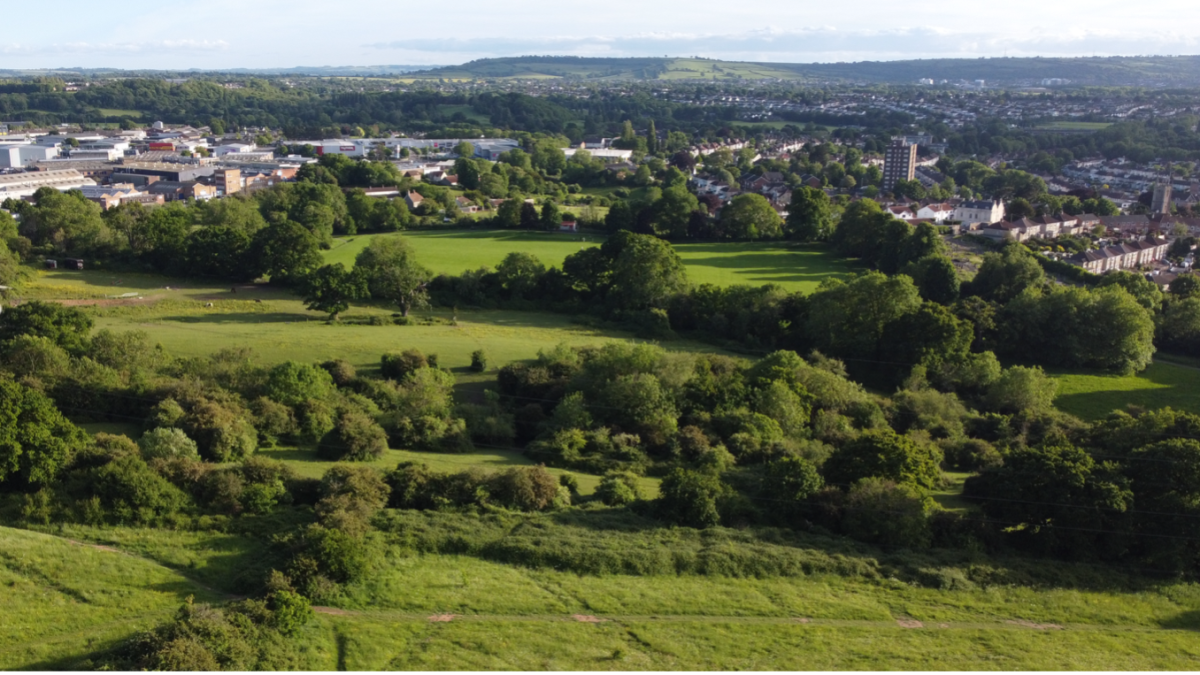
Brislington Meadows sits on a steep hillside. The only road in or out joins Broomhill Road at the top of the site, and the lowest homes would sit eight to ten metres below it – roughly the height of a three-storey building.
Every journey to or from the lower part of the estate means climbing or descending that slope.
What the rules say
Government design guidance for streets and cycle routes (known as LTN 1/20) allows a slope of 1-in-20 – climbing one metre for every 20 you travel – for no more than 30 metres before a level resting place is needed.
That figure exists for a reason: a 1-in-20 slope is the recognised limit for wheelchair users, and even then only in short stretches.
The developer’s own drawings show:
• Road eight runs at exactly the 1-in-20 limit for 55 metres – nearly twice what the rules allow, with no resting places.
• Road ten runs at almost 1-in-20 for 54 metres, and Road four for 50 metres.
• Road three, the estate’s main spine road, climbs continuously for over 100 metres – well beyond the recommended maximum for its slope.
• In total, the council’s highway officers found six of the estate’s roads fail the standards.
These aren’t back-street shortcuts. The engineering profiles show the estate hangs off a single spine road (road three) descending from the Broomhill Road entrance, with the three steepest roads (four, eight and ten) branching off it down the hill.
Between them, they are the only routes connecting the lower homes to the way out. The developer’s Street Hierarchy Plan below shows how the roads will be laid out and their hierarchy.
Oddly, none of the plans submitted with the application actually labels these road numbers – not the site plan, the masterplan or the engineering layouts. To work out which street is which, the technical note had to reconstruct their locations from junction markers on the engineering drawings.
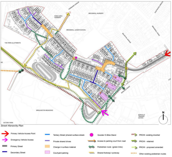
The developer’s Street Hierarchy Plan (Design and Access Statement, §3.7). The red arrow at the upper right is the only vehicle entrance, off Broomhill Road; the grey “primary street” is the spine from which the steepest roads branch off down the hill
What that means for real people
If you use a wheelchair or mobility scooter, push a pram, or simply find hills hard work, the lower part of the estate would be effectively out of reach without a car. Cyclists face the same slopes.
The proposed footpaths don’t help – many are mown grass or loose gravel, which Active Travel England – the government’s own walking and cycling watchdog – said “can in no way be argued to be accessible, inclusive or fit for purpose.”
There’s a longer-term catch too. Roads this steep may never be “adopted” (taken over and maintained) by the council. If not, residents themselves could be left paying indefinitely for road repairs, drainage and lighting on streets the council considers substandard.
Haven’t the developers fixed anything?
The new application proposes offering all the roads for council adoption rather than just two – but the roads themselves are unchanged, gradient for gradient.
Offering a non compliant road for adoption doesn’t make it compliant; the council’s highway team has already declined to adopt roads that fail the standards.
Why this can’t really be fixed
The slope is a fact of the land. To descend nine metres at a wheelchair-friendly gradient you would need a path 180–360 metres long – and the approved outline layout leaves no room for it.
That is why the planning committee refused the last application, against their own officers’ advice, and why the same objection applies to this one. No amount of tweaking can flatten the hill; only a fundamentally different design could.
Want the detail?
This article summarises an independent technical assessment of the developer’s own engineer-certified drawings, including a road-by-road breakdown, the relevant national and local policies, and an analysis of the officers’ reports.
Read the full technical note here.
This is an opinion piece by Lucy Bell-Reeves, a member of the Save Brislington Meadows campaign group.
Main image: Mark Ashdown
Read next:
 Our newsletters emailed directly to you